研究内容・Research
本研究室では、現地調査・数値計算・リモートセンシング・機械学習などの手法を活用し、 沿岸域・沿岸都市の保全・防災減災、洋上風力発電を支える技術に関する研究を推進しています。
Our laboratory conducts research on technologies for coastal conservation, disaster prevention and mitigation, and offshore wind energy through the integrated use of field surveys, numerical modeling, remote sensing, and machine learning.
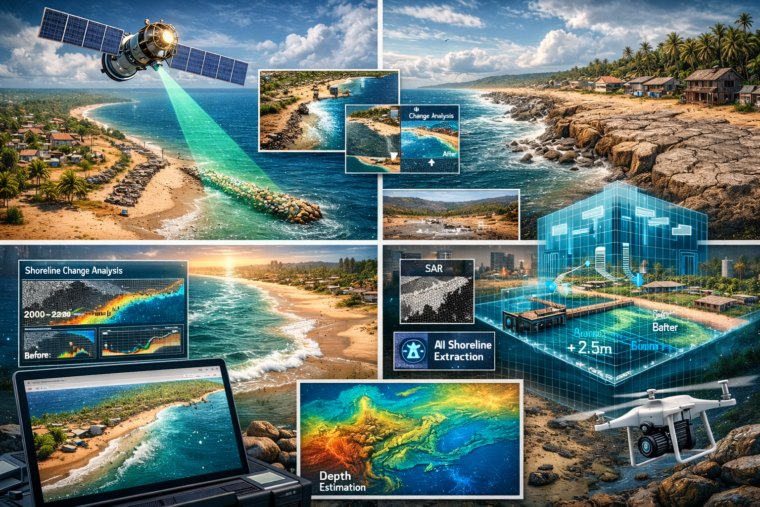
1. リモートセンシング技術を活用した海岸モニタリング / Coastal Monitoring Using Remote Sensing Technologies
UAV、光学衛星、合成開口レーダ(SAR)などの多様なリモートセンシングデータを活用し、 海岸モニタリングと海岸過程の理解・解明に関する研究を行っています。
Our research focuses on coastal monitoring and the understanding of coastal processes through the use of diverse remote sensing data, including UAVs, optical satellite imagery, and synthetic aperture radar (SAR).
- 光学衛星画像を用いたガーナ沿岸域における侵食対策構造物の効果分析
Analysis of the effects of coastal erosion control structures along the Ghanaian coast using optical satellite imagery - 能登半島地震に伴う隆起後の海浜変形応答の解析
Analysis of beach morphological response after coseismic uplift caused by the Noto Peninsula earthquake - 光学衛星データによる西アフリカ沿岸の長期・広域海岸線変動調査
Investigation of long-term and large-scale shoreline changes along the West African coast using optical satellite data - 衛星SARを活用した海岸帯管理におけるデジタルツイン適用可能性の検討
Feasibility study of digital twin applications for coastal management using satellite SAR - 深層学習を用いたSAR画像からの自動海岸線抽出
Automatic shoreline extraction from SAR imagery using deep learning - 単一SAR画像を用いたうねり場いよる水深推定
Bathymetry estimation in swell-dominated coastal areas using a single SAR image
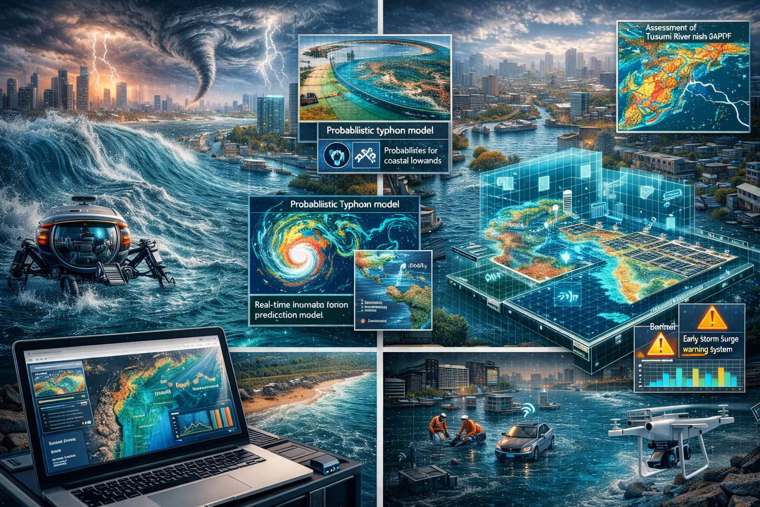
2. 沿岸都市域における水災害リスク評価と防災・減災 / Risk Assessment and Disaster Prevention/Mitigation for Water Hazards in Coastal Urban Areas
高潮、極端降雨、洪水を含む複合的な水災害を対象として、 都市域の浸水予測とリスク評価に関する研究を進めています。
Our research focuses on inundation prediction and risk assessment in urban areas, with particular attention to compound water-related hazards, including storm surges, extreme rainfall, and flooding.
- 都市浸水モデルの開発
Development of urban inundation models - d4PDFを用いた鶴見川流域の都市浸水氾濫リスク評価
Assessment of urban inundation risk in the Tsurumi River Basin using d4PDF - 沿岸低地におけるリアルタイム浸水予測のためのデータ同化モデルの構築
Development of a data assimilation model for real-time inundation prediction in coastal lowlands - 確率台風モデルと機械学習を組み合わせた高潮災害の確率的早期予測手法の開発
Development of a probabilistic early warning method for storm surge disasters by combining stochastic typhoon models and machine learning
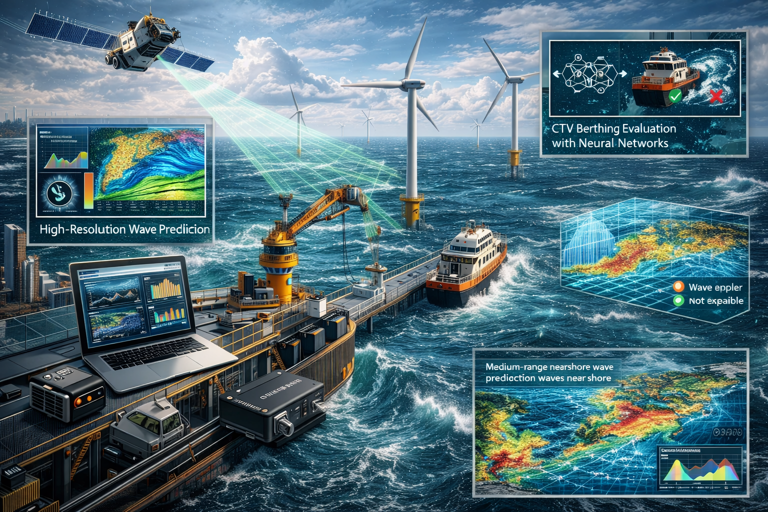
3. 洋上風力発電事業における施工・運用の効率化と最適化 / Efficiency Improvement and Optimization of Construction and Operations in Offshore Wind Projects
洋上風力発電の建設・運用を支えるため、複雑海況下における施工・運用支援技術の研究を行っています。 小型IMUを用いた船舶動揺計測、ニューラルネットワークによるCTVの接岸可否評価、 機械学習による波浪予測の高解像度化に取り組んでいます。
Our research focuses on improving the efficiency and optimization of construction and operations in offshore wind projects. To support offshore wind construction and operation under complex sea states, we develop technologies for construction and operational support, including ship-motion measurement using compact IMUs, neural-network-based evaluation of CTV berthing feasibility, and machine-learning-based spatial refinement of wave forecasts.
- 小型IMUを用いた可搬型船舶動揺量計測システムの構築
Development of a portable ship-motion measurement system using a compact IMU - ニューラルネットワークを用いたCTVの接岸可否評価
Evaluation of CTV berthing feasibility using neural networks - 全球波浪アンサンブルシステムとニューラルネットワークによる近岸波浪中期予測
Medium-range nearshore wave prediction using a global wave ensemble system and neural networks - 機械学習を用いた中期波浪予測の空間高解像度化
Spatial high-resolution enhancement of medium-range wave prediction using machine learning
4. 海上養殖を支えるモニタリング・水理・スマート管理技術 / Monitoring, Hydrodynamics, and Smart Management Technologies for Offshore Aquaculture
海上養殖の持続的な発展を支えるため、リモートセンシング、数値流体解析、画像解析、機械学習を組み合わせた研究を行っています。 衛星画像や高解像度画像を用いた養殖施設・養殖海域の把握、養殖水槽や養殖船内の流れと自浄性能の評価、養殖網まわりの流場解析、 水産物の品質評価などを通じて、効率的で環境負荷の小さいスマート養殖技術の確立を目指しています。
We develop monitoring, hydrodynamic analysis, and smart management technologies to support sustainable offshore aquaculture. Our research integrates remote sensing, computational fluid dynamics, image analysis, and machine learning to map aquaculture facilities and zones, evaluate flow fields and self-cleaning performance in aquaculture tanks and vessels, analyze flow around aquaculture nets, and assess fish quality using computer vision.
- 衛星画像・高解像度画像と深層学習を用いた養殖施設・養殖海域の抽出
Mapping of aquaculture facilities and zones using satellite/high-resolution imagery and deep learning - 養殖水槽・養殖船内における流れ場と自浄性能の評価
Evaluation of flow fields and self-cleaning performance in aquaculture tanks and offshore aquaculture vessels - 養殖網まわりの流場解析と施設設計への応用
Flow-field analysis around aquaculture nets and its application to facility design - 画像解析・機械学習を用いた水産物の品質評価
Fish quality assessment using image analysis and machine learning
